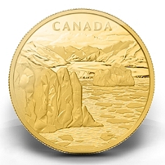
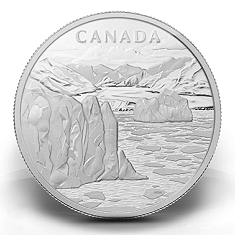
In July, 2012, I was contacted by the Royal Canadian Mint and asked to submit drawings for two "Canadian Arctic Landscape" Coins. After almost two months of work, and various variations on the theme, the final drawing was selected and engravers at the mint went to work. Immediately below, you will see the results of their work: two 1Kilo coins; one gold, one silver. Follow the links to see different aspects of the coins on the RCM website - larger images and video - and find out more about the image itself.
"Celebrating Canada’s Far North! Sculpted by relentless winds, grinding ice and bitter cold, the vast, open Canadian Arctic landscape embodies the ancient spirit of Earth's glacial past. Locked in twilight for much of the year, cast in blinding contrast for its few months of midnight sun, the Canadian Arctic is like no other place on Earth." > > > |
Coin images© 2013 Royal Canadian Mint – All Rights Reserved |
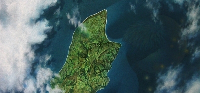
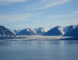
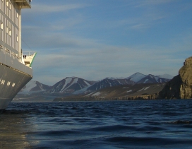
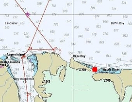
The image featured on these coins portrays the mountainous coastline of Baffin Island, at the entrance to Canada's Northwest Passage. The pictures below provide a slightly different perspective, and an overview of this area in general. (Image 3) Near the channel to Pond Inlet, just east of Cape Hay, a red swatch marks the actual location of this scene.
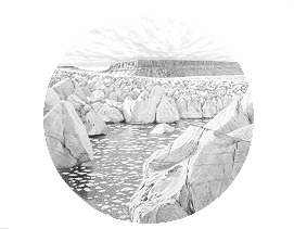
Images in the "Arctic Gallery" (The portfolio section of my web site) looked as if they might translate well to the engraver's art, and one image in particular, Starboard Bow, caught the eye of representatives at the mint. This was the starting point for preliminary sketches. Though a different image was chosen in the end, it was hoped this painting might be used for the packaging. Production time-line issues meant this wasn't to be, however, I've included the image (for this update) on the index page. The drawing I made of this location (At the foot of the calving Crocker Bay glacier) is the fourth image below (2nd row - right).
 |
|
 |
Baffin Island coast - between coin view and Cape Hay |
|
View of mountains from Cape Hay, returning to Ioffe |
| |
|
|
 |
|
 |
The north shore of Baffin Island - image location (red) |
|
Crocker Bay Glacier: one of the alternate image drawings. |
| |
|
|
 |
|
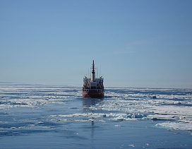 |
Ice already blocked the channels in to Pond Inlet, around either side of Bylot Island, and pack ice soon drifted into the waters offshore, blocking our onward journey as well. |
|
CCGS Des Groseilliers clears our way east, to Resolute and our flight back to Ottawa. See Map for an overview of the area, and details of the 2006 Arctic Quest journey. |
 |
After arriving back from Greenland, ice block all the ports along the north shore of Baffin Island, including Nanisivik (The next inlet west of Bylot Island). This was an alternate departure point for our journey home, instead, after crossing Lancaster sound to Dundas Harbour, Crocker Bay, Beechey and Prince Leopold Islands, the Ice Breaker Des Groseilliers arrived to clear a channel west. Our journey continued onward, through the Northwest passage to Resolute. |
To see the original drawing for the coin image above, and receive regular (usually bi-monthly) updates, please fill out the mailing list request form at: "Contacts"
|